From field to usable data, without intermediate steps
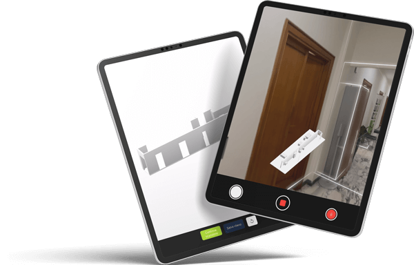
Acquire physical space in real time, generates 3D models, vector plans e mesh high definition, reducing time, errors and rework. Data flows immediately into the ecosystem REFTree for technical management, intervention planning and valorisation.
Features and use cases
Key features
Scan LiDAR e computer vision with AI from mobile devices
Immediate outputs: 2D plans, mesh, 3D models (DXF, USDZ)